My Take on The Odyssey
Christopher Nolan’s film The Odyssey has arrived. I haven’t seen it yet but I certainly plan to do so. Homer’s Odyssey has always been one of my favorite pieces of classical literature, beginning with an illustrated children’s version I first read when I was ten years old. Since that time I’ve probably read the story in various translations a dozen times. As you’ll see from the photo below, I keep a copy of it, and its companion, The Iliad, on my shelves next to my volumes of The New Annotated Sherlock Holmes. Essential reading, at least in my home.

Some time ago, a younger and far more ambitious version of me decided to write and compose a song cycle based on The Odyssey. It’s one of my more esoteric efforts, equally inspired by the original tale as well as that epic slog of modernist literature, James Joyce’s Ulysses, and the spoken word songwriting of performance artist Laurie Anderson. Here’s my official description of the work.
Either a lo-fi concept album or a set of songs from a non-performed performance piece. Very loosely based on Homer’s Odyssey. Composed during a time when I was also working as a sound tech and theatrical sound designer. A mixture of musical influences including Laurie Anderson, Lou Reed, Philip Glass, Brian Eno, and Leonard Cohen. Recorded in my apartment using a Korg Poly-61 synthesizer, a Tascam 4-track cassette recorder, a Shure SM58 microphone, and a motley assortment of percussion instruments.
The central conceit of my story involved a man and a woman living together in a large city. They become estranged, then separate and reunite over the course of one long night. The title I came up with was Tides of the Heart. Here’s the opening song, On the Strand.
I should point out that the original versions of The Odyssey were performed by Homer in a song-like recitation, part of the rhapsode tradition. I like to think my own spoken-word/musical take on the story honors that tradition. In theory, anyway. In practice, I’ll leave it up to you to decide. To my ears it retains an offbeat, shambolic charm. A bit noisy in places, but with some lyrical heft and musicality. My favorite individual songs are Blue Sweater, Build a Home and Venus if you want to skip to the “hits”.
You can listen to Tides of the Heart in its entirety below.
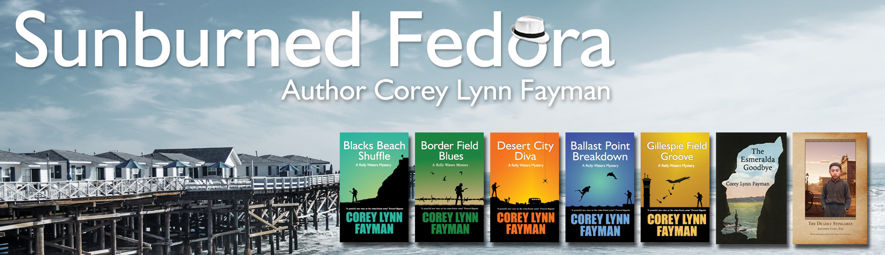
Mapping My Books
However you may feel about Google and its parent company Alphabet, their maps application has been a great resource for writers (and most everyone) since it was first made available over twenty years ago. It’s pretty much a standard resource for me now when I’m working on a new book. There are two main ways I like to use it.
The first is one is to confirm the fictional geography of my book. Each Rolly Waters mystery is set in specific neighborhoods of San Diego. As a long-time resident, I’ve already visited some of the places where my characters go. Sometimes they go places I haven’t been so I’ll take a couple of hours to explore the area. I’ll write down some notes and take photographs.
Memories, notes and photos are great to have on hand but inevitably, as I’m putting my characters through their paces, a question will come up that I can’t answer. How long would it take a character to drive from one place to another? On foot? What can they see from a particular location? Questions like this pop up all the time as I’m writing. And that’s when I turn to my trusty Google Maps.
As I was writing Gillespie Field Groove I wanted two of the characters to be able to look down from a house and see an FBI raid taking place at buildings on the west side of the Gillespie Field airport. Here’s the view of the airfield I was able to find from Google Maps.
There’s several houses on the other side of the street, set back from the street on small hill. The geography worked! I could write the scene as I wanted.
Authenticity like this certainly isn’t required when you’re writing fiction, but I think it makes things more interesting, at least in the case of the Rolly Waters mysteries. I’ve had to finesse certain place descriptions sometimes but, on the whole, I usually get the geography right. And I think the books are better for it.
Which brings me to my favorite use of Google Maps. Inspiration! As I browse through areas of San Diego County I’m featuring in the next book, I’ll discover things that give me new ideas for where the story, and the characters, can go.
The climactic chapters of Ballast Point Breakdown take place in the Coronado Islands, just off the coast of Baja California. I’d seen them in the distance for years but knew very little about them. I took a closer look on Google maps and discovered the Mexican government has two outposts on the island—Faro and Faro Sur. There’s also a well-protected cove on the northeast side of the largest island, a place where someone in a sailboat could anchor and shelter their boat. There’s a trail leading up from the cove to other government buildings on top. I glanced through comments and photographs. There were videos of pods of dolphins and stories of a 1930s casino. All sorts of ideas started popping into my head, many of which made it into the final version of the story.
Google is great of course, but what happens when you’re writing historical fiction? I go searching for historical maps. I don’t get as much information as I do from Google, but they still can be useful. Here’s an 1899 map of San Diego County I often referred to when I was working on The Deadly Stingaree.

This map helped me understand the route President Harrison’s train took during his 1891 visit (and helped me imagine how it might be diverted). I discovered names for towns I’d never heard of before—Fruitdale, Nestor and Oneonta—which have since been incorporated into larger cities such as Chula Vista and Imperial Beach. The map also gave me a sense of how uninhabited and agricultural the southern part of the county was at the time, giving me some more ways to tell the story.
Maps, maps, maps. A writer’s best friend (maybe second best after a Thesaurus).
Filibusters & Fools
“From what I have read in The Sun,” he said. “Mr. Smith has turned his editorializing powers against the Mexican government in Baja. He greatly encourages the filibusters.”
John Sigerson, The Deadly stingaree, Chapter 23 The nursery

When we hear the word filibuster today, most of us think of it as a strategy senators use to prolong debate on proposed legislation, delaying its passage. In the United States of the 19th century the term often meant something else, referring to private citizens who raised an army of mercenaries to invade foreign countries for personal gain. Some hoped to rule their own fiefdom or, using Texas history as a model, establish a territory that would eventually be annexed as an American state. Most of these attempts took place during the 1850s, before the American Civil War.

Photo By Mathew Benjamin Brady – Public Domain
The most successful of these filibusters, at least for a while, was William Walker. His early attempt to invade Baja California and Sonora was driven back by Mexican forces but he remained undeterred. Walker and his mercenaries, supported by the Nicaragua Democratic Party, invaded and took control of Nicaragua in July 1856. Walker set himself up as the country’s president. Two years later, a military coalition led by Costa Rica defeated Walker’s army and forced him to resign. He received a hero’s welcome upon his return to the United States, particularly in the Southern and Western states.

Photo By Scott Raine
Walker’s third expedition fared poorly. Encouraged by British settlers in Honduras, Walker arrived in Trujillo to meet with them and carry out his plan for overthrowing the government. Instead he was arrested by the Royal Navy and turned over to the Honduran government. He was tried for piracy and filibusterism and executed by firing squad at the age of 36.
Filibusters were often strong supporters of slavery, intending to set up new slave states with their conquests. The defeat of the Confederacy in the Civil War cooled their fervor. But in the 1890’s a San Diego man named Walter Gifford Smith, owner of the Sun newspaper, and British Major Buchanon Scott, an Afghan war veteran and manager of the Mexican Land and Colonization Company, plotted a takeover of Baja California.
Under the guise of building a railroad from Ensenada to San Quintin, Smith, Scott and their co-conspirators planned to bring 300 recruits disguised as railroad workers into Mexico. On the night Smith and Scott were to throw a party for local Mexican officials their men would attack, and presumably defeat, the garrison of Mexican soldiers in Ensenada.

Smith had grand visions for himself if the filibuster succeeded. He would become President and Governor-General of Lower California. He even went as far as writing a Declaration of Independence and an inaugural address. He designed a new flag.
Fortunately for probably everyone, the plot was leaked to a rival newspaper. Under duress, Smith and his co-conspirators abandoned their plan and denied all the charges. The era of filibusters & fools had come to its ignominious end.
The Deadly Stingaree

April 23, 1891. San Diego, CA. A presidential visit. A secret plot against the United States. This recently discovered manuscript tells the remarkable story of a 14-year-old Chinese orphan and his notable friends—a notorious gunslinger, a former Buffalo soldier, a crusading female attorney, and the world’s greatest detective—who saved the president and the union that day.
Covenants & Lost Neighborhoods
I recently visited the San Diego History Center to view the San Diego’s Lost Neighborhoods exhibition, which examines the local history of African-American communities displaced by redlining, freeway construction, and other discriminatory policies. One of those lost neighborhoods was in La Jolla, which was the setting for my historical novel The Esmeralda Goodbye.

This may come as a surprise to anyone visiting La Jolla today, but at one time a significant black population considered it home. As you’ll see in this map from the exhibition, black residents represented more than ten percent of La Jolla residents in the 1950s, the highest percentage of any community in San Diego at the time.

The map confirmed something I’d felt when I was writing The Esmeralda Goodbye. As a kid who grew up in La Jolla in the late fifties and sixties, I remembered a small but thriving black community you won’t find there today. It was one of the things I wanted to capture in some small way in my novel. The characters of Mabel and Willie Denton, Charlie Buchanon and Mr. Bell as well as Mr. Parker’s Little Pig BBQ were all inspired by memories of people and places from that time.
There were a number of reasons for the decline of the African-American population in La Jolla, but the most heinous and deliberate were the restrictive property covenants. Black residents were allowed to live in the homes of their employers but were otherwise confined to specific and less desirable parts of the town if they wanted to own their own home. As you’ll see from below, the covenants were used to keep anyone who wasn’t White or Caucasian from purchasing, renting or leasing residential properties. This restriction was intended to exclude Jewish owners as well.


As hinted at in my novel, the pending arrival of the University of California in the 1960s brought political pressure that resulted in the covenants being overturned. But the black community of La Jolla had already started to move on. As of 2023 the black population of La Jolla hovered around 1%.

In Search of Old San Francisco
It’s been a long time since I visited San Francisco. Back in my younger days it seemed like I went up there every couple of years. The Left Coast Crime Conference was held in San Francisco this year and it gave my wife and I an opportunity to make a return visit. After the conference was over, we spent a couple of days revisiting the city.
One of the things we like to do when we travel is to seek out the old stuff—restaurants, bookstores, parks and buildings that act as cultural repositories for the city’s soul, its living history.
With that in mind, one of the first places we visited was the City Lights Bookstore, leftover from a time when bookstores played a major role in the cultural life of our cities, a place where readers, writers, artists, intellectuals, and other movers and shakers would meet. City Lights is best known for its role in San Francisco’s social and political movements in the second half of the twentieth century. First opened by poet Lawrence Ferlinghetti in 1953 the store, and its publishing arm, became ground zero for the Beat movement after publishing Allan Ginsberg’s Howl and Other Poems, the first volume in its ongoing Pocket Poets Series.
Best of all, City Lights is still in the same location and still going strong. And it’s still a place where you can “participate in that ‘great conversation’ between authors of all ages, ancient and modern.” (Ferlinghetti)


The weather was nice so we spent a few hours at the San Francisco Botanical Garden and the Japanese Tea Garden in Golden Gate Park.


For dinner we went to Tadich Grill, the oldest continuously run restaurant in California (third oldest in the United States). Established in 1849 by Croation immigrants, it’s a European-style bistro featuring a long wooden bar, white-linen service and an old-fashioned, but still delicious, grill menu. It manages to be both classy and a lot of fun. You rarely find places like this anymore (especially in California).


Not all of our adventures were historical. We got a glimpse of the future when we rode in a Waymo self-driving taxi.

Here’s sixteen seconds of our journey from inside the taxi. The future is here. We’ll have to get used to it.
And last, but not least, we made a visit to the Musée Mécanique, with its wondrous machines from the past, including this Mighty Wurlitzer player piano.